
Parish bracing for spillway opening
To ease the rain-swollen waters of the Mississippi River, the U.S. Army Corps has announced it will open the Bonnet Carre’ Spillway in Norco on Sunday and could also open the Morganza Spillway as soon as Tuesday.
The Corps will start opening the spillway at 10 a.m. to keep water flow from exceeding 1.25 million cubic feet per second and avoid flooding in areas of Louisiana. It could remain open for several weeks depending on flood waters.
St. Charles Parish is preparing for the opening.
Brandon Touchard, with the parish’s Emergency Operations Center,said parish officials met with area industry representatives Wednesday to update them on river projections and how it could affect their dock operations.“A lot of industries know what to do,” he said. “We did this four years ago.”
Parish officials also are talking to the state Department of Transportation and Development about putting a sand berm along Airline Highway, Touchard said. The move prevented flooding from overtaking the roadway with the 2010 spillway opening.
All recreational activities will likely be ceased on the spillway, which is between Norco and Montz, in anticipation of the released floodwaters. Touchard said the parish recreational workers have picked a lot of equipment out of the spillway area.
The Corps also has suspended all work within 1,500 feet of the levee. The restriction will remain until the river level falls below 15 feet and then will require a waiver to resume work.
Corps spokesman Ricky Boyett said the public is being advised “to maintain a high level of vigilance for their safety. Once of the leading causes of fatalities during a flood is people trying to drive through flood waters so if they come across water over the road, don’t try and drive across it.”
Boyett also advised against visitors using jet skis near the spillway.
On Tuesday, Col. Richard Hansen, commander of the New Orleans District of the Army Corps of Engineers, announced the first bays of the weir at the spillway could be opened this weekend. The move will depend on when the water flow reaches 1.25 million cubic feet per second, which is expected to occur Saturday based on National Weather Service projections.
Maj. Gen. Michael Wehr, commander of the Corps’ Mississippi River Division based in Vicksburg, Miss., who oversees the entire river, approved the recommendation this week.
If approved, the Corps could open all 350 bays at the spillway to lower the rain-swollen waters threatening levees in the New Orleans area, funneling a portion of the river into Lake Pontchartrain. A press conference will be held the day of the opening at the spillway.
The Corps is also considering opening the Morganza Floodway above Baton Rouge, a decision that relies on two meetings with stakeholders further upriver and in the Atchafalaya River Basin. Wehr must also approve this opening.
State and federal officials have been monitoring the river rising, which is responsible for flooding across the Midwest with some areas reporting as much as a 5- to 10-inch increase in rainfall. The rain-swollen river has caused serious damage in Missouri and Illinois, and the water has been moving south.
As of Sunday, the river was 34.23 feet in Baton Rouge, nearing flood stage of 35 feet. In New Orleans, the river was at 13.22 feet by Friday and expected to crest at 17 feet or the flood stage by Jan. 12.
In New Orleans, the goal is to keep the river level no higher than 17 feet or at water flow of 1.25 million cubic feet per second. As of Sunday, it was 910,000 cubic feet per second.
Boyett said the Corps and levee districts stepped up levee inspections to every day as of Jan. 6 until water elevation falls below 15 feet on the Carrollton Gauge in New Orleans. Inspections were already at twice a week.
“Our expectation is that all 330 to 350 bays will be opened,” Boyett said of the Bonnet Carre’ Spillway. “As the water rises, the bays are opened so the river stays at 1.25 million cubic feet per second.”
The process begins with cranes placed atop the spillway structure to pull 20 timber “needles” or pins from each of the bays that will be opened, he said. If all the bays are opened, it could take about 20 days, and the total of bays to be opened will rely on when the desired water flow is achieved.
The Bonnet Carre’ Spillway opening would mark the 11th time it has been opened since its construction in 1931 and marked the earliest the 5.7-mile weir has been opened. Congress authorized construction of the structure after the historic 1927 Mississippi River flood to divert flooding from populated areas like New Orleans.
The Corps recently removed some of the weir’s wooden pins at the spillway, which serve as a dam against rising waters.The spillway was last used in 2011, from May 9 to June 20, as well as the Morganza Floodway.
Waters overflowing the area’s trail system have already required closure of Bonnet Carre’ Spillway Road as of Jan. 3. The road will remain closed to traffic until future notice. On the same day, the Corps closed the ATV area in the Spillway, while other areas in the Spillway remain open to visitors.
“Environmental, hydrologic, structural, and navigational considerations all bear on the decision to open Bonnet Carré,” according to the Corps. “Other factors affect the decision are the overall condition of the levees and the ability of the river to pass flows, and the effects high water and river currents may have on vessels navigating the river.”
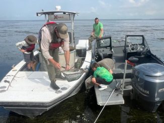
The Corps will assess water quality, dissolved oxygen, sedimentation, recreation, and natural resources such as the pallid sturgeon, both within the spillway, as well as Lake Pontchartrain.
The Corps has asked all third-party users and grantees to take immediate steps to remove their movable property and protect existing facilities and immovable property within the spillway.
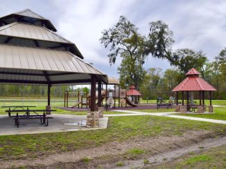
Additionally, all public access areas within the spillway, including the public boat launches, Lower Guide Levee Road, and the St. Charles Parish Recreation Area near U.S. Highway 61 will be closed beginning on Sunday, Jan. 10, until further notice.
The U.S. Coast Guard has advised closure or restrictions as result of the flooding, including high-water towing limitations near Morgan City for southbound vessels up to 600 feet long. The Coast Guard also issued closed portions of the Upper Mississippi River to river traffic on the upper Mississippi River in St. Louis, Mo., on the Illinois River in Illinois, as well as the Ohio Valley and Lower Mississippi River.
The Louisiana Governor’s Office of Homeland Security and Emergency Preparedness, which also has been monitoring levels along the Red River and Mississippi River since late December, announced some control actions were likely warranted in coming weeks.
On Tuesday, the Louisiana Department of Wildlife and Fisheries announced it closed deer hunting season as of Dec. 29 in parts of northeast and central Louisiana because of flooding.

Be the first to comment