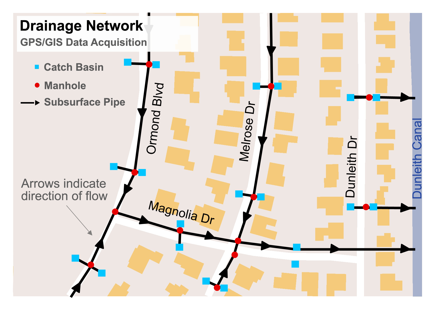
The parish was able to create this aerial map that shows the direction of water flow in the Ormond and Red Church subdivisions. The information was gathered by parish workers using GPS devices, which saved the parish money by not having to use a firm to c
Be the first to comment