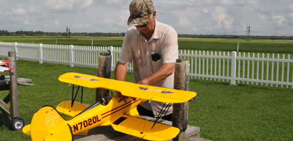
Against a cerulean sky sprawling over the more than 7,000 acres of the Bonnet Carre’ Spillway area in Norco, Harold Berner watched his bright yellow Waco model airplane soar in a circle and then glide into a landing on the ground.The RC Recreational Area – Bleakley Airfield is an important location for this LaPlace model flyer, as well as his 40 fellow members of the Spillway RC (remote control) Club who rely on it for their hobby.
They’ve been coming to the field a little over a year for fun and competitions, Berner said.
“Fields are closing,” he said as he adjusted the Styrofoam body of the nearly 3 pound aircraft. “So right now, this is about the only place we have.”
Tim Milioto, also of LaPlace, who recently resumed the hobby, was also at the airfield flying his Cessna model.
The airfield is part of a sprawling complex in St. Charles Parish managed by the U.S. Army Corps of Engineers, and it’s much appreciated by the people who frequent its many recreational features.
Chris Brantley, Bonnet Carre’ Spillway project manager, said the spillway is also part of the comprehensive plan for flood damage risk management in the Lower Mississippi Valley.
The spillway is the southernmost floodway in the Mississippi River and Tributaries Project (MR&T), and provides extensive outdoor recreational opportunities in the area.
Visitors who come to the site can reach 400,000 a year.
The area is a one-stop recreational haven.
Many of them come for the activities, including fishing, crawfish, hunting, dog training, camping and wildlife watching. More specialized activities include ATV and motorcycle riding areas, retriever dog field trials and model airplane flying competitions.
Birders are drawn to opportunities to see eagles, tricolored herons, pelicans, red-tailed hawks, little blue herons, black-necked stilts and the yellow-crowned night heron.
Brantley said the spillway offers two boat launching sites and a primitive campground by St. Charles Parish. Two park rangers manage the area’s resources, as well as assist visitors.
“We’ve got dirt,” added Brantley, pointing to several piles of dirt dredged from area waterways that the Corps makes available to area residents. Rich in nutrients, the dirt can be taken by the bucket or truck load.
At the waterway that locals call the “Upper Suction,” Barr Soltis had just dropped his fishing line in the river waters of the upper guide levee, which is on the LaPlace side of the spillway.
Having just heard about a woman who caught a 30-pound catfish there, Soltis, also of LaPlace, was eager to try his luck.
Brantley said the Corps calls the waterway the “Upper Borrow Canal” because the land was “borrowed” through dredging and created the body of water.
Nearby, in what residents call the “Suction Dredge,” Adam Rockweiler and his son, Kaleb, were crabbing.
Kaleb was swimming more than crabbing, but his father loved watching him having fun.
“We come here often,” Rockweiler said raising a crab line and tossing a small crab back into the water. Although this little guy was free again, he said he’d caught some larger crabs and was intently working on catching more.
He also pointed to neighboring ponds and talked about the good fishing in them, particularly after recent floodwaters restocked them with good catches.
According to Brantley, “The area draws area people for crabbing and fishing instead of going that extra two hours to Grand Isle.”
The spillway also offers a 5.5-mile loop trail near LaPlace used for hiking, walking and mountain biking. Dogs are also able to use this trail.


Be the first to comment