St. Charles Parish has issued a voluntary evacuation for residents who live in low-lying areas that generally have issues with flooding during heavy rain and storm surge events.
Current forecasts of Tropical Storm Barry for the parish are calling for sustained tropical storm force winds and gusts from 39 mph to 74 mph, potential storm surge of 3 to 6 feet and possible rainfall up to 17 inches with a high risk of flash flooding.
Officials urge residents to take every possible precaution to prepare for wind, heavy precipitation, storm surge and widespread power outages that will be caused by Tropical Storm Barry.
The parish is under the following National Weather Service alerts:
– Flash flood watch through Sunday morning, which means conditions may develop that lead to flash flooding. Flash flooding is a very dangerous situation.
– Flood warning with the Mississippi River through Sunday.
– Tropical storm warning is in effect with Barry continuing to strengthen and expected to become a hurricane when it reaches the Louisiana coast. The storm is moving toward the west-northwest near 5 mph (7 km/h). A motion toward the northwest is expected to begin later today, followed by a turn toward the north Saturday night. On the forecast track, the center of Barry will approach the central or southeastern coast of Louisiana tonight and then make landfall over the central Louisiana coast on Saturday. After landfall, Barry is expected to move generally northward through the Mississippi Valley through Sunday.
– Storm surge watch with possible significant impacts across coastal areas of southeast Louisiana and Mississippi. The potential for 4 to 6 feet above within surge-prone areas.
For St. Charles Parish, the Edward A. Dufresne Community Center is open for residents to shelter in place. Residents should prepare to take care of themselves without help for several days. Be sure a preparedness kit includes basic items and for each person. It should include important identification documents, personal items such as clothing and toiletries; a small pillow per person and an extra blanket, and prescription and over-the counter medicines, and first-aid kits.
Items not allowed:
- Alcoholic beverages
- Weapons
- Drugs or drug paraphernalia
- Contraband
HESCO baskets have been put up along Bayou Des Allemands in the anticipation of high water.
Garbage pickup will start today (July 12) at 3 a.m. Residents are advised to refrain from putting out large items and tree limbs in front of their homes, and are asked to pull in their trash cans after serviced.
CLOSURES
- St. Charles Parish Government offices will be closed today (July 12). All essential personnel will report to work.
- The Department of Parks and Recreation has canceled adult basketball for July 11.
- The Planning Commission meeting scheduled for tonight has been cancelled and all cases will be heard at the Aug. 1.
- Council on Aging offices will be closed Friday.
- Divison “D” Judge M. Lauren Lemmon will not hold court today. All cases will be rescheduled and all parties will be notified of future dates.
- St. Charles Parish Clerk of Court’s office will be closed until Monday (July 15).
- The Ormond Spray Park will be closed until Monday.
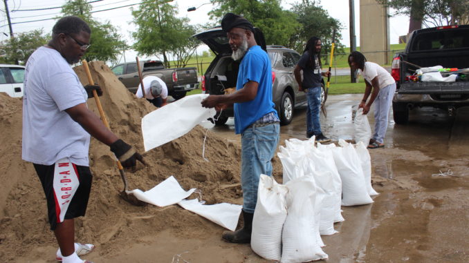
SANDBAGGING
All sandbagging locations are now open. For a full list of sandbag locations, click here.
The EOC is currently accepting sandbag requests from elderly and people with disabilities.
LEVEES
In discussions with officials in the National Weather Service River Forecast Center, there are no threats or concerns regarding the overtopping of the Mississippi River levee in St. Charles Parish based on the current forecast.
Any questions may be directed to the St. Charles Parish Emergency Operations Center at (985) 783-5050, 24 hours a day. Parish social media sites will be updated continuously at www.facebook.com/stcharlesgov and www.twitter.com/stcharlesgov. Please call 1-800-ENTERGY for information on power outages.


Be the first to comment