
Waterworks, drainage, planning all getting ‘smarter’
St. Charles Parish has been installing smart meters that can be read by remote signal.
The parish’s Department of Waterworks has been replacing the current meters – that require a meter reader to manually record the data or the bill – with AMR (automatic meter reading) meters.
The project is nearly 45 percent complete.
“We can read the meters much more efficiently, allowing our staff to spend more time on other matters,” said Waterworks Director Robert Brou. “It also aids us in answering customer inquiries about their water usage. Ultimately, it will reduce the size of the meter reading staff, diverting the funds used for those expenses to be used for distribution, treatment and infrastructure improvements to our system.”
Brou also said the new meters speed up the process of retrieving meter readings.
“It gives us a ‘leak alert’ when water has passed through the meter for every hour of a twenty-four hour period,” he said. “In addition, we are able to do data logging; getting hourly readings from the meters when the customer is having trouble understanding when water was used. This is very useful when they have experienced a leak.”
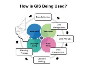
The parish’s GIS (Geographic Information Systems) Office also is collecting information about each meter, which allows waterworks employees to view the data in a web-based map application.
In addition to the water meters, GIS Coordinator Luis Martinez said his department’s projects also include building databases on drainage, aerial photography, streetlights and road signage.
“All too often the parish GIS Office comes across situations where we are called in because no one has any information or reference materials such as recorded drawings, site plans or subdivision plats that show the location of utilities,” Martinez said.
The GIS Office is frequently tasked with locating buried pipes and cables, property boundaries and servitudes or right of ways, he said.
“Without mapping these utilities or infrastructure, the same issue will present itself over and over again,” Martinez said. “Utility-infrastructure mapping with GPS is a great way to preserve their location for future reference.”
The GIS System allows for the parish’s information to be displayed in a straight-cut way so decision makers, planners, etc., can visualize and interact with information.
 Martinez said it allows them to see the utilities that lie beneath the parish’s streets and infrastructure.
“For example, a typical utility map that shows sewer, water and drainage infrastructure but doesn’t have a lot of background information displayed other than maybe the pipe size and type,” he said. “The GIS provides much more information tied to these utilities, like the length, direction of flow, material, depth, and more. This makes it easier to plan for emergencies and maintenance of the particular utility.”
The GIS system also facilitates instant access to data and allows easy sharing of information across the various parish departments making it easy to meet the parish’s needs for planning and making informed decisions.
“With real-time access to critical information, it becomes easy to analyze the ‘big picture’ and understand the relationship between different types of information from different departments before arriving at any conclusions,” Martinez said. “The GIS eliminates the time and effort spent on translating information by ensuring that every department, project engineer, and/or contractor uses the same information in real time.”


Be the first to comment